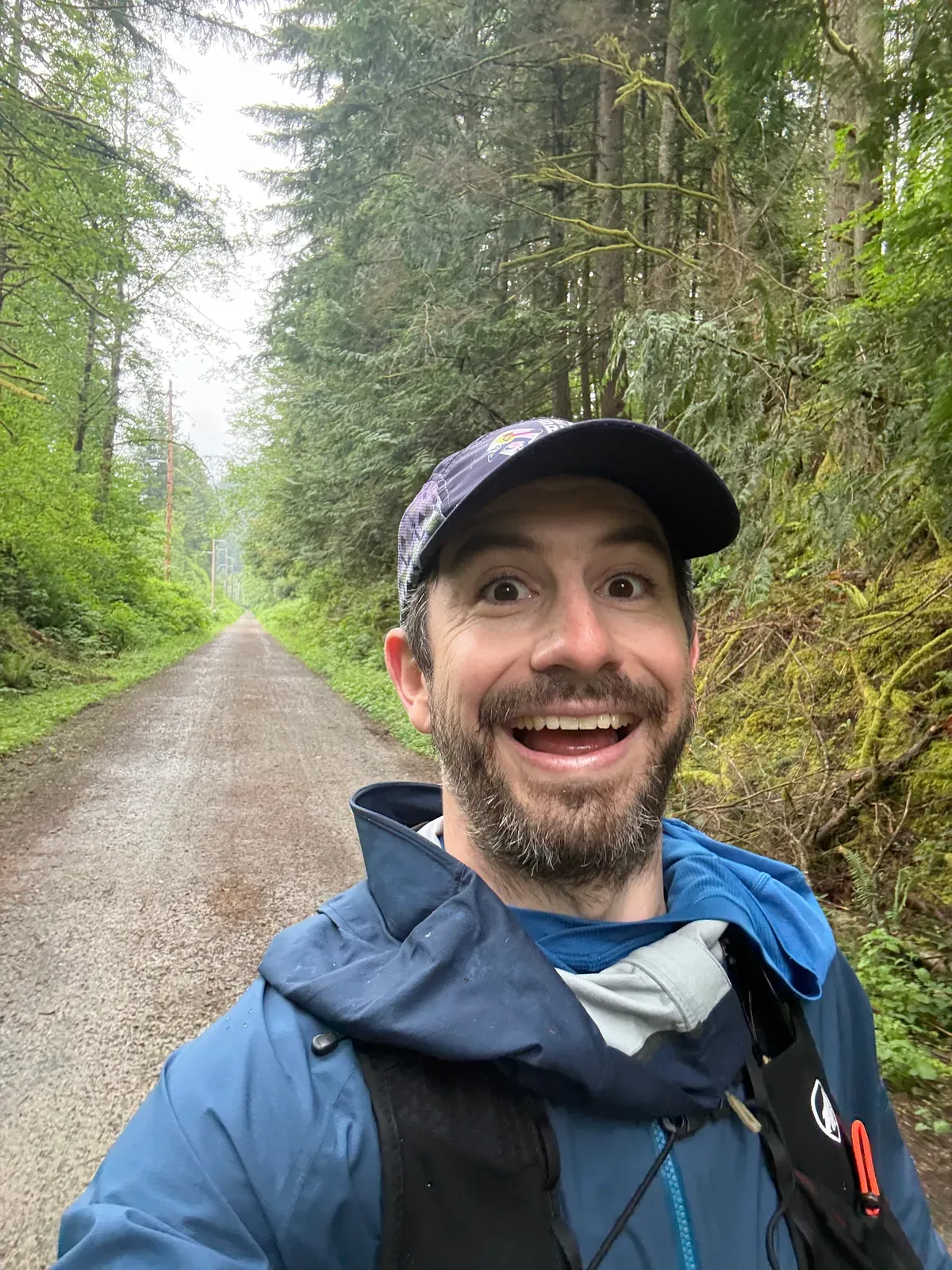
Birthday Bash 2026
Mileage: 30 miles with 9000 feet of elevation
As described in my Cascade Crest Lottery post, I’ve refocused my training on a 100 mile goal in mid-July. As part of that goal, I need to do a 50 mile training run with 6500 feet of gain before June 14th to prove I won’t die out there. Conveniently, I was also planning to take some time off around my birthday for an adventure, so I decided to shoot for 50 miles at the end of May.
In Washington, especially up in the mountains, May can still be quite wintery. Anything above 5000 feet is almost guaranteed to have snow into June, and depending on storms, the snow can go lower as well. Because of this, I came up with about 6 different “low elevation” 50-mile training routes and would make a decision as the day got closer. Most of the routes were fairly well-traveled trails that I hadn’t fully explored, but there were a few… “adventure” options.
Tracking the weather beforehand, I saw that a ton of snow had melted in May, so any of the options would likely be fine. I was a little worried about some sesamoiditis I have in my left foot though, so I didn’t want to get too far out into the woods in case something went wrong and I needed to bail. I also didn’t know how much mileage my body could actually handle. I had taken off the entire month of April to let my foot heal, so I certainly wouldn’t be in peak condition. If I wasn’t feeling great, I wanted the ability to adjust the plan and shorten my hike if needed.
One of the routes that I thought was pretty reasonable went from Rattlesnake Lake up the backside of Mount Washington, traversed over to Olallie Knob, descended to cross the highway, took the fire academy connector to the Mailbox Peak trailhead, connected over to the Granite Creek trailhead, crossed Middle Fork Road to get to the CCC trail, connected to Mount Si, came through North Bend for a cheeseburger, and finished with a full Rattlesnake Ridge traverse to get to 50 miles and 9000 feet of climbing. It seemed relatively close to civilization and connected mostly well-traveled trails, so I wasn’t worried about getting stuck anywhere, and I’ve been curious for years about connecting Dirty Harry’s with Mailbox, so I’d finally be able to answer that question. Combined with the multiple resupply options (gas stations, Scott’s Dairy Freeze) and bail points (could easily do 25, 35, or 50 miles), I thought it was my best option for an adventure. What could go wrong?
What could go wrong: part 1 - rain
Lots of rain.
I somehow chose the only day within a week of my birthday that was supposed to be rainy and cold. I knew this from the forecast, but I had already taken the day off work and my wife had found childcare support for the day, so I didn’t want to cancel. I looked at the predicted precipitation amounts and assumed that it would be damp and misty, but not actually raining, so I’d be fine with a rain coat and extra socks. Unfortunately, I was wrong.
Driving out to the trailhead, it was cloudy but surprisingly dry, so I thought maybe I was in the clear. That notion was quickly corrected when I got to North Bend and it started pouring rain. There’s nothing quite like climbing out of a warm bed at 5 o’clock in the morning, driving in your warm car, then forcing yourself to get out into 45 degree rain to go hike for 12 hours. Quite the wakeup call!
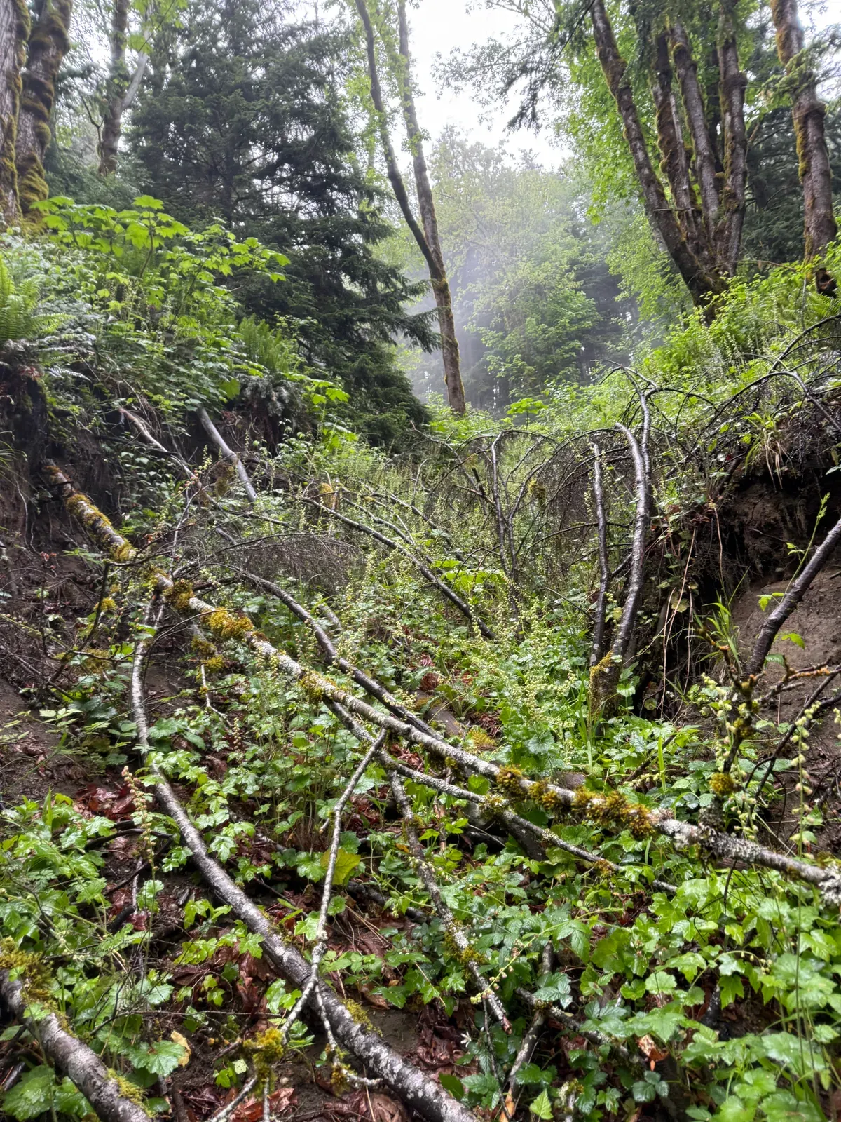
The first mile or so was on a great trail that was flat and wide, but unfortunately, the next part of the Palouse to Cascades trail was washed away by landslides during some storms in December, so I got to go around. As soon as I turned, the atmosphere changed into a wet, uphill jungle where I had to bushwhack through soaking wet bushes and trees. The “trail” is clearly not used often, and was so overgrown you couldn’t tell where to go. Sometimes I’d follow my map, sometimes I’d follow some stupid pink ribbons tied on trees that were definitely wrong. Eventually I got to a reasonable (bike) trail and was able to pick up the pace, ticking off 10 miles and 3500 feet in just over 2.5 hours.
What could go wrong: part 2 - “trail”
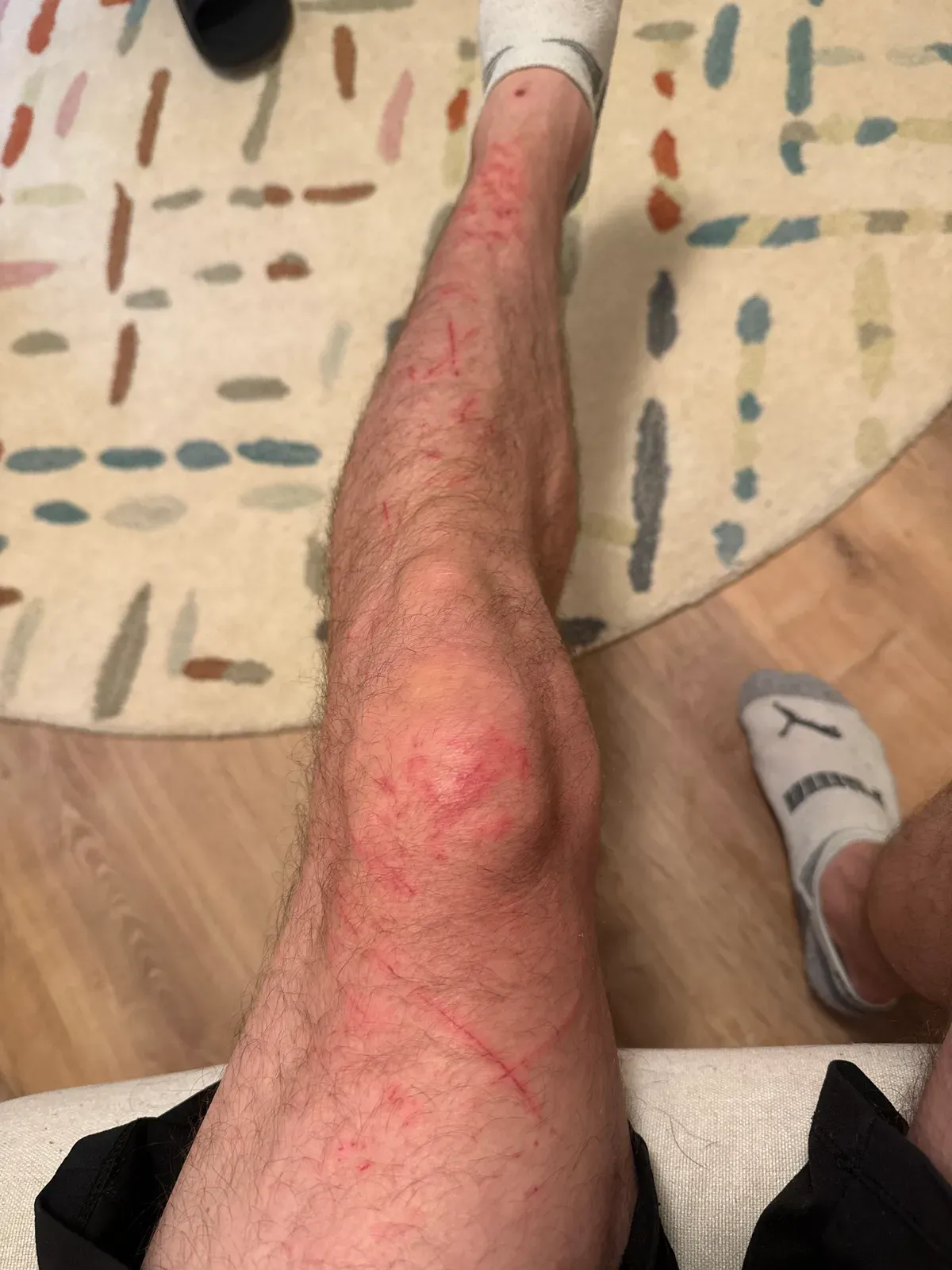
The trail was “bad” for the first couple miles, “good” for a few more, and then “absurd” for a couple after that. It was raining too hard to justify taking my phone out for pictures (not to mention that my hands were frozen and couldn’t actually use the phone), but believe me when I say that this “trail” was one of the worst I’ve ever been on. You could definitely tell there had been a forest service road there in the past century, but the slide alder and thorny berry bushes have taken over and made progress a hard-fought battle. I scraped my legs a ton going around Change Creek Pond, but I honestly didn’t care because I was so cold and wet. Once I got back onto a “trail”, it was more overgrown bushes soaking me with every step, so I was soon shivering and running just to keep warm. The “connector” I took to connect the forest service road to Change Creek Trail was a hilarious jumble of fallen trees, bushes, and no discernable trail at all. Maybe I immediately lost the trail, but it didn’t look like another human has been back there in years.
Finally, I got to Olallie Knob, finished the brutal descent, and got past what I hoped would be the hardest part of my day.
What could go wrong: part 3 - no trespassing
Washington State Fire Training Academy.
After descending to the highway, my plan was to run the road from Dirty Harry’s Balcony trailhead to the fire training academy and either connect directly to North Bend on Grouse Ridge Road or take the connector to Mailbox Peak if I was feeling up for 50 miles. Sadly, I was not feeling up for 50 miles, so I planned to take Grouse Ridge Road.
I typically plan trips in Gaia by drawing a bunch of colorful lines on the map and connecting existing trail systems. This usually works, but sometimes Gaia has outdated or incorrect information about trails, so it’s useful to double check. I know this. I’ve been bitten by this in the past. In this case, I DID double check with Google Maps, which happily routed me along Grouse Ridge Road to the Twin Peaks gas station. Easy.
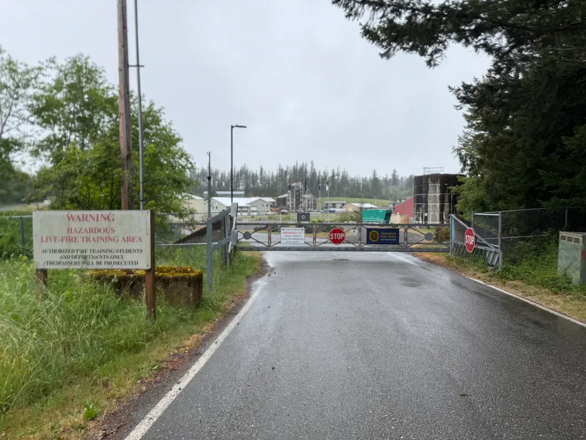
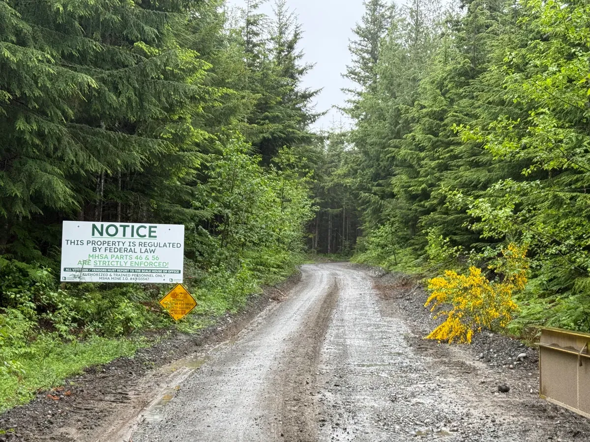
That route is not even slightly real. Not only is the road blocked at the fire training academy, but even if you get around that to the West and follow the road from there, it’s blocked again by a mining operation.
I ended up backtracking away from the fire academy to try to find a way around, and I DID find a way around! Some little leprechaun had a similar idea to me, and had left a barely discernable trail through the massive blackberry bushes, which I followed until I got to the end of the fire academy fence. I had been paying close attention for no trespassing signs, but I hadn’t seen any, so I figured I was on public land and fine.
The travel was incredibly slow through this portion, trying to bushwhack through massive blackberry bushes, hundreds of fallen trees, and a landscape completely devoid of trails. It took me almost an hour to get back to the road, where I was immediately greeted with the gate to the mine. I didn’t want to bushwhack back the way I came because it took so long and then I’d have to run the three miles back along the road, so I decided to look for alternative bail options. On a satellite map, I saw a trail through the bushwhacky wild that led down to some power lines, whose path had been cleared and I could hopefully use to get back to an open trail. I decided that was my best option, and started walking that way, getting further and further away from my last planned route point.
I walked for about 15 minutes, and as soon as I got to the power lines, my heart sank. On the satellite image it had seemed reasonable to connect the power lines to trails down the road, but I hadn’t looked at a topo map or I would have realized that there were massive hills and cliffs in between the power line poles. Everywhere without a trail was covered in thorny bushes, so it wasn’t realistic to make progress in that direction. I was starting to worry that I’d have to spend 2 hours bushwhacking back the way that I came, but I decided to do one last exploratory jaunt to see if I could find a more direct way down to the highway.
I found a trail peeling off from the power lines that appeared to be used for servicing AT&T fiber optic cable, so I followed that until it started directing me into the mining area. Not where I wanted to be. Instead, I looked at the map and saw that the closest public road was only about a quarter mile away, but it was also 450 feet below me. I looked over the edge of the hill in a few different spots, and one of them looked pretty clear and reasonable. It was just ferns and duff as far as I could tell, so it would be easily passable compared to the way back. I decided that it was worth a shot, and I could always climb back up if necessary. How bad could it be?
It turns out that 450 vertical feet is a lot more than I thought, so I had only seen about a quarter of the descent from the top. As I should have expected, everything beyond that point was heinous. Thorns, downed trees, zero visibility to the ground, boggy wetlands… this section had it all. Every step downhill brought me closer and closer to salvation and added more elevation to regain if I turned around, but there was no guarantee that I could fully connect to the road. I took this section extremely slowly, constantly reminding myself that if I impaled myself here and fell under the bushes, it could be months before someone found my body. Even if I didn’t maim myself on a downed tree, I was still worried about hitting an impenetrable thicket of blackberry at the very bottom that would force me to turn around.
Luckily, the world smiled upon me and the bottom was just normal blackberry bushes and an ankle deep mud pit, so I was able to power through and get back to the road. My eternal hope is that the 450 foot descent down from those power lines will forever remain my worst ever trail experience.
What could go wrong: part 4 - hunger
So what did we learn? Neither plan A nor plan B worked.
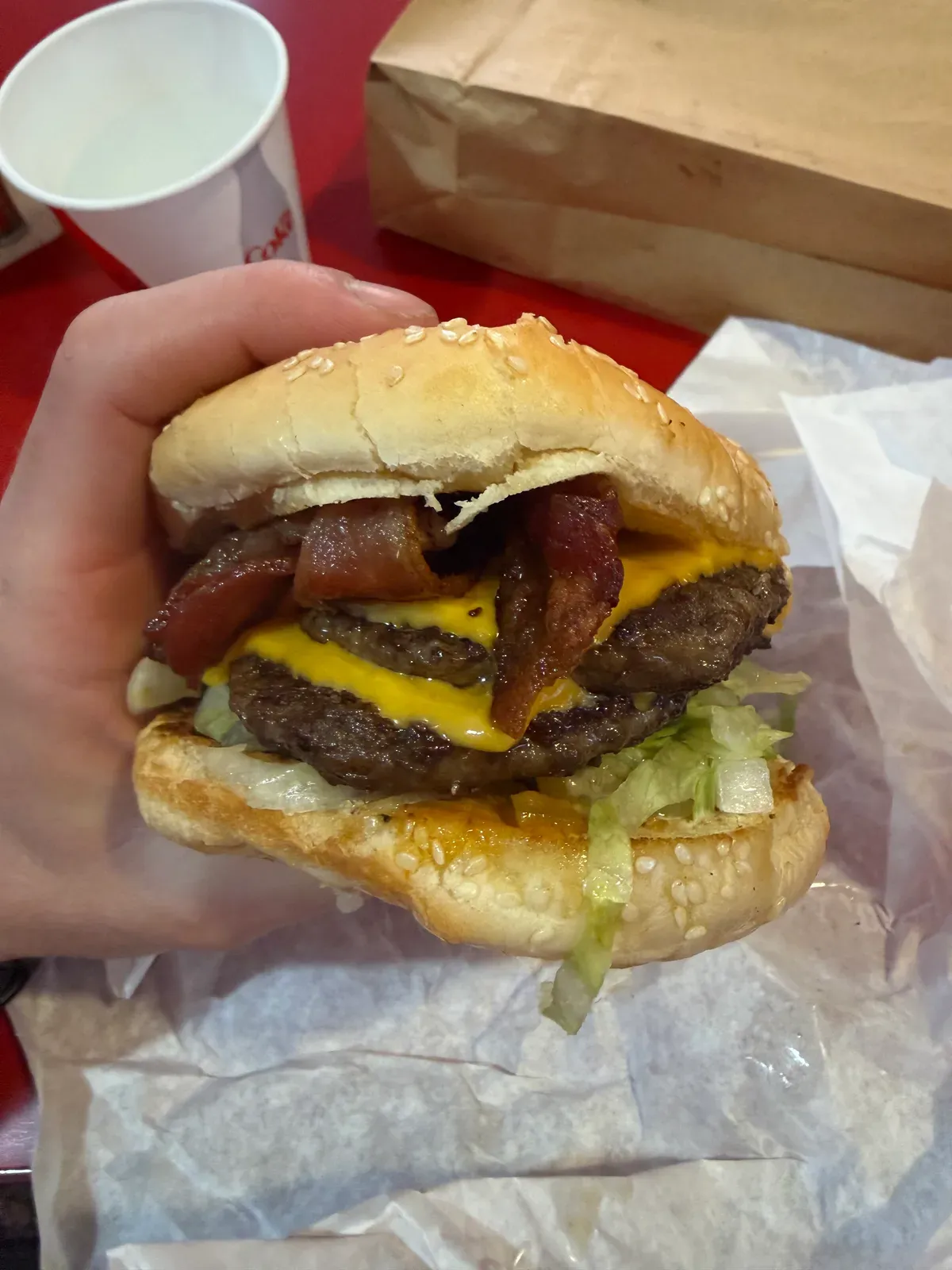
Where did that leave us? On the wrong side of the highway with no way to resupply without hitchhiking or going back the way we came. I had planned to stop at both Twin Peaks gas station for some refreshments and then make my way to Scott’s Dairy Freeze for a burger and milkshake, but both of those were now off the table. The bad news is that I had packed assuming I would resupply halfway through, so I was going to run out of fuel. I had a water filter and electrolytes, but no food for what would now be a 3500 foot climb and 12 miles back to the car. Ugh.
I also wasn’t sure if I could connect to the normal Mount Washington trail instead of having to backtrack along the terrible trail past Ollalie Knob. Honestly, I would have just hitchhiked at that point. Luckily, I discovered that I could go back a much much easier way than I came.
The hike up, and across, and down, and across, and up some more was fairly uneventful. I saw my first and only hiker of the day, but mostly kept myself busy by singing and coming up with sarcastic mantras for the day, like “this isn’t stupid, you’re stupid”. Obviously I had to relive the morning’s soaking wet bushwhack one last time, which was just as enjoyable in the afternoon. Towards the very end of my trek back, I realized I would be at 8900 feet for the day, so I did a quick side trip up Cedar Butte, because if my legs are already destroyed, they can’t hurt any more, can they? I tagged the top and then hobbled down to my car and my dry set of clothes, hoping to forget this entire day even happened.
Post trip
I learned a lot today. Not necessarily the “fun” kind of lessons, but useful nonetheless. I also DID have fun, as much as the experience was horrible at points. I think I find joy in the absurdity of type 2 fun, so it’s not actually that terrible in the moment. I don’t think I’m going to start seeking out cold, rainy bushwhacks, but I’m not opposed as long as I prepare correctly.
I also learned that my plan B route was real, but I didn’t internalize how people did it. Apparently you need to leave the road to the east of the fire academy and bushwhack for a bit to get to the connector trail. I had just figured the beta I remembered was from a pre-gate era, but that may not have been the case.
Lessons learned:
- The map always looks easier than real life
- Figure out questionable routes beforehand
- Use Gaia private land layer to see if you have to cross private land (which has bitten me three times now)
- Use Strava heatmaps to see where other people have gone
- Do deeper research on beta and internalize what it says
- Prepare for the worst
- Bring insulation/gloves/hat if it’s going to be cold at all
- Bring enough food to get back to your car, especially if you’re not sure about your route to resupply
- Proatively communicate changes to the plan
- I was texting my wife before/during the god-awful bail, but I wasn’t clear that she should be tracking my location closely so the cadaver dogs could find me easier
- My body isn’t ready for 100 miles in July - I could try, but the risk of injury is higher than I want 😔
- The sesamoiditis was not a limiting factor, it was mostly leg/knee strength/durability
- Good news! Lots of other fun adventures out there without grinding my bones into a pulp
- Thorns are everywhere once you get off trail (and also sometimes when you’re “on trail”)